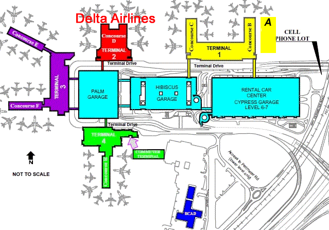
Fort Lauderdale Airport Directions and Map
Directions to Fort Lauderdale Airport FLL, easy to use Google maps and turn by turn Directions.

Google Map of Fort Lauderdale Airport
GPS ADDRESS Fort Lauderdale Airport 100 Terminal Drive, Fort Lauderdale, Florida 33315
Click the airplane icon on the map for DIRECTIONS
Click in the pins for hotels near Fort Lauderdale Airport
View Fort Lauderdale International Airport in a larger map
From the North:
Take I-95 South to I-595 East. Bear right onto U.S. 1 (South Federal Highway) and take the Airport exit.
Follow the directions into the Airport.
From the South:
Take I-95 North to I-595 East. Bear right onto U.S. 1 (South Federal Highway) and take the Airport exit.
Follow the directions into the Airport.
From Fort Lauderdale beach:
From AIA, go West on Sunrise Blvd. (or Las Olas Blvd.) to Federal Highway. Go South on U.S. 1 (South Federal Highway) to the Airport exit.
Follow the directions into the Airport.
From I-595
Take exit 12A and proceed south on US-1. Turn right at Griffin Road and turn right at the traffic signal just beyond the rail road tracks.
Merge right on to Perimeter Road. The Cell Phone Waiting area will be on your left, 1 mile straight ahead.
From US-1 Southbound
Turn right at Griffin Road and then turn right at the traffic signal just beyond the rail road tracks. Merge right on to Perimeter Road.
The Cell Phone Waiting area will be on your left, 1 mile straight ahead.
From US-1 Northbound
Turn left at Griffin Road and then turn right at the traffic signal just beyond the rail road tracks. Merge right on to Perimeter Road.
The Cell Phone Waiting area will be on your left, 1 mile straight ahead.
From I-95 and Griffin Road Eastbound
Take Griffin Road east. Turn left at the traffic signal just before the rail road tracks at US-1. Merge right on to Perimeter Road.
The Cell Phone Waiting area will be on your left, 1 mile straight ahead.
